First, labyrinths
are often connected
with fertility through stories in which they are the scene of meetings
in springtime between male and female, or earth and sky deities, thus
beginning
each year’s new cycle of vegetation and growth.
Second, the roadway suits
wagon ceremonies,
such as of the fertility goddess in the wagon described by
Tacitus.
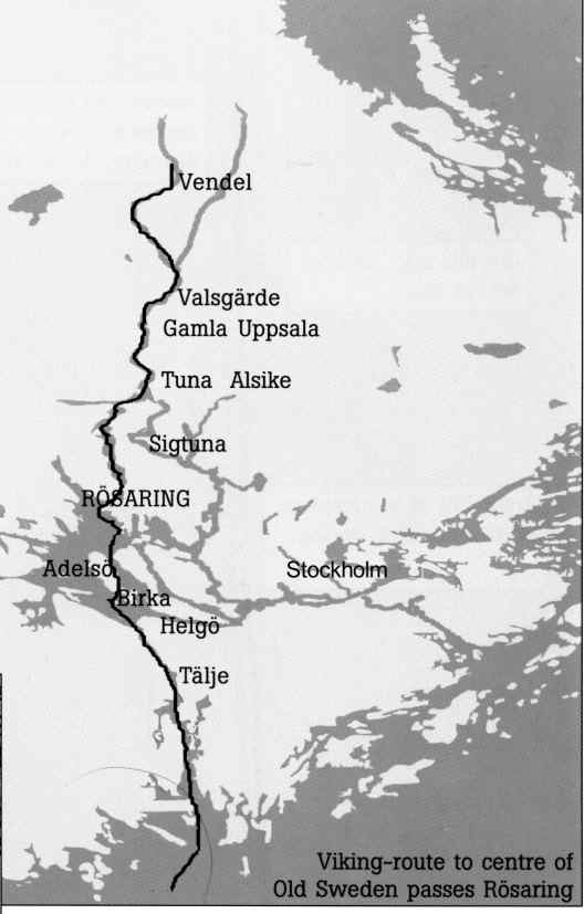
Third, place names in the
neighbourhood
also call attention to a fertility cult. About 5 km from Rösaring
we find the names Härnevi and Ullevi, which refer to the female
earth
goddess Härn (Nerthus) and her male counterpart Ull, a sky god,
both
from the period before the Viking Age. A similar pattern of place names
is to be found near all labyrinths lying on ridges crossing Lake
Mälaren,
as shown by John Kraft in a book published by UKF in 1999.
The labyrinth
The labyrinth at Rösaring was associated
with ancient
gods already in 1684, when Hadorph, known as the “father” of Swedish
antiquarian
research, wrote: “… on a high hill … where there is a Troijenborg
...
there has been much sacrifice to the gods in olden days”.
Labyrinths in Sweden have long been called
“Trojeborg”
(City of Troy), pointing to a link with Mediterranean countries, where
such labyrinths were common before the Roman Empire. The Minoan culture
of Crete even used labyrinths as symbols on their coins. Beside the
labyrinth
on the famous Etruscan vase from Tragliatella is written a name meaning
Troy. Full scale or field labyrinths in these countries have not
survived.
There are some turf examples elsewhere in Europe, but today the
majority
of field labyrinths are in Scandinavia. Here they tend to survive more
readily, being built of stones in a sparsely populated country. Most
Swedish
labyrinths are near the coast, built during recent centuries for quite
different reasons to the 20 or so labyrinths found inland on ancient
sites,
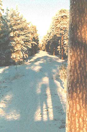
such as Rösaring.
|
|
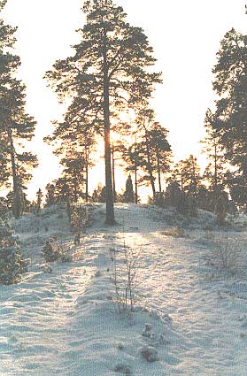
| Photo 1. Looking south toward the
flattened mound
at noon on midwinter day. Photo Börje Sandén |
Typically, these labyrinths have only one path
leading
to the centre - a round, winding pathway defined by 8, 12 or 16 rings
of
small stones. Mazes with blind paths did not appear until the 15th
century.
The historical form of
labyrinths
is said to be a symbolic city or castle, (borg in Swedish) from which a
woman had to be liberated. The Homeric story of a ten-year siege to
free
the fair Helen of Troy may be a relatively recent tale, based on the
original
ancient myth in which the woman in question was a fertility divinity,
to
be delivered with symbolic rites from her winter prison at the start of
spring. We do not know for certain how this was done - no doubt it was
in many different ways in various places and times, according to tales
from all over the world. It is worth noting that in the church of Sibbo
in Finland, a picture of a labyrinth includes a girl at the centre.
|